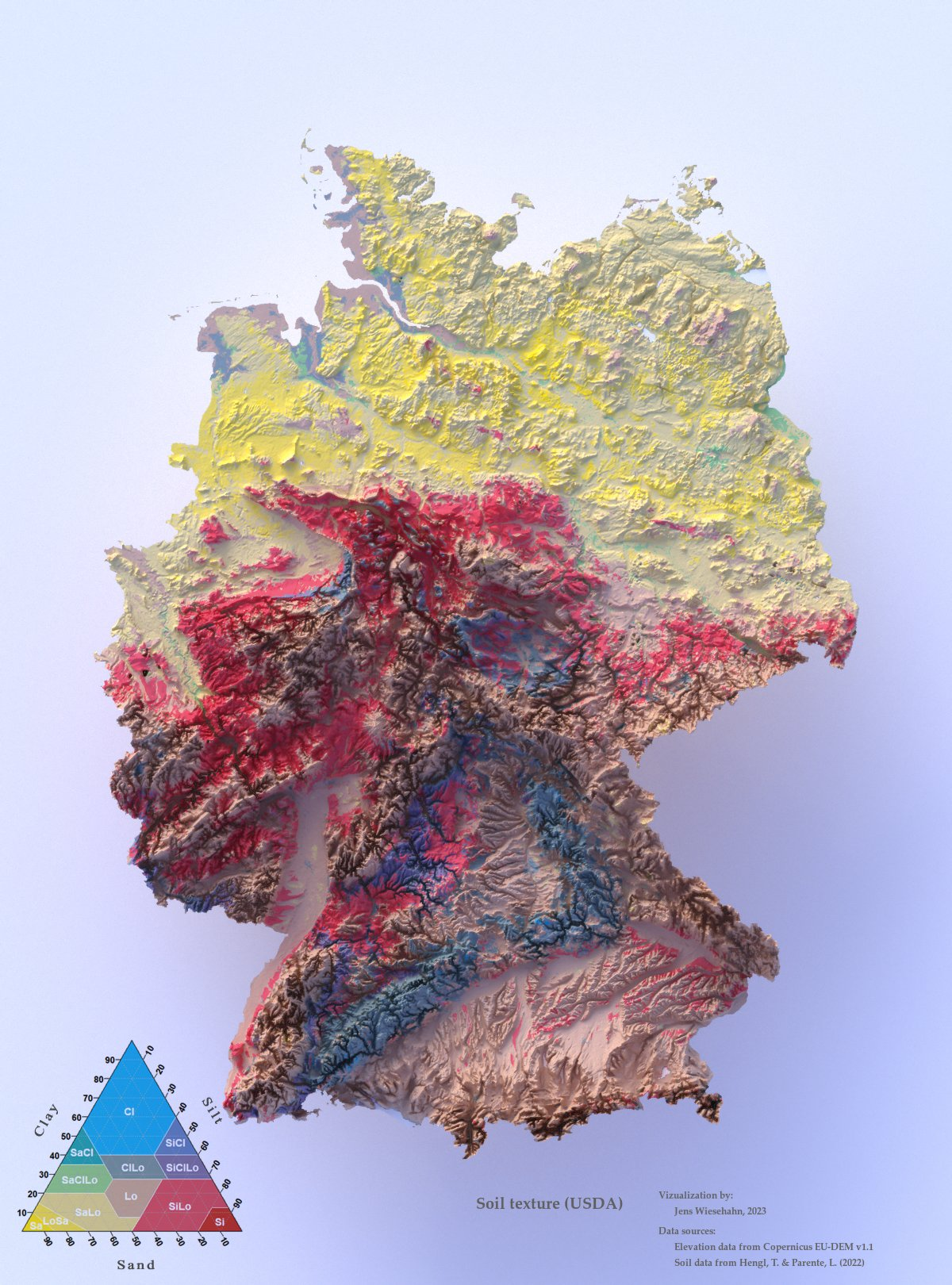

확실히 저지대하고 고지대가 뚜렷하게 구분이 되는 모습을 볼 수 있습니다.
지도는 Rstat과 여러 가지 라이브러리를 이용해서 만들었다고 합니다.
※ 출처: https://twitter.com/JensWiesehahn/status/1633892936726241281
트위터에서 즐기는 @JensWiesehahn@fosstodon.org
“Topographic map of Germany showing soil texture. (proportions of sand, silt and clay sized particles) The map is made entirely in #RStats #rayshader #maps #cartography #soil”
twitter.com
'지리 관련' 카테고리의 다른 글
| 실제 기상 데이터로 풍선을 날리는 지도 (0) | 2023.04.25 |
|---|---|
| 유럽 전역의 하천 유역 (1) | 2023.04.20 |
| 유럽 연합+스위스 전역의 건물 데이터베이스, EUBUCCO (0) | 2023.04.16 |
| 2023년부터 적용되는 네이버 지도 API 요금 인상 (0) | 2022.12.02 |
| 동적 지도 라이브러리 OpenLayers 공식 트위터 계정이 차단됨 (0) | 2022.11.27 |