https://www.bbc.com/news/science-environment-64603521
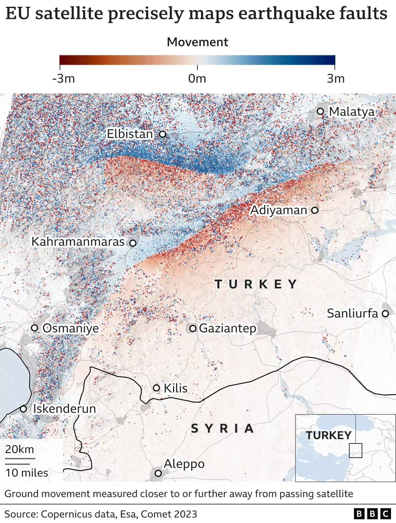
Turkey earthquake fault lines mapped from space
The EU's Sentinel satellite system traces how the ground ruptured during Monday's big tremors.
www.bbc.com
지표 고도는 유럽 우주청에서 운영하는 센티널 1A호(Sentinel-1A)의 합성개구레이다(Synthetic Aperture Radar, SAR)를 이용해 측정했다고 합니다.
'지리 관련' 카테고리의 다른 글
| 위성 사진으로부터 인도 및 보도를 식별하는 오픈소스 AI (0) | 2023.05.05 |
|---|---|
| 주사위로 여행지 정하기 지도 (0) | 2023.05.02 |
| AI로 만든 가짜 위성사진 모음 (0) | 2023.04.26 |
| 실제 기상 데이터로 풍선을 날리는 지도 (0) | 2023.04.25 |
| 유럽 전역의 하천 유역 (0) | 2023.04.20 |