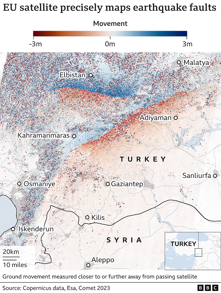
튀르키예-시리아 지진 전후의 지표 고도 변화
·
지리 관련
https://www.bbc.com/news/science-environment-64603521 Turkey earthquake fault lines mapped from space The EU's Sentinel satellite system traces how the ground ruptured during Monday's big tremors. www.bbc.com 지표 고도는 유럽 우주청에서 운영하는 센티널 1A호(Sentinel-1A)의 합성개구레이다(Synthetic Aperture Radar, SAR)를 이용해 측정했다고 합니다.